Arkansas River Fishing Spot
- Elevation: 289'
- Last Modified By: vinny60 on 09/10/09 06:35 PM
- Ask about Arkansas River in our Fishing Forums
Photos
Fish Species
Comments
-
Have you fished at Arkansas River? Be the first to comment on this fishing spot.
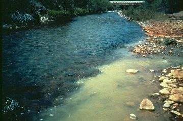
Arkansas River Description
The Arkansas River is a major tributary of the Mississippi River. The Arkansas generally flows to the east and southeast, and traverses the states of Colorado, Kansas, Oklahoma, and Arkansas. The Arkansas River flows from west to east and has abundant game fish, including largemouth and striped bass. The public use areas along the river are managed by the U.S. Corps of Engineers who developed the McClellan-Kerr Arkansas River Navigation System. Completed in the 1970's, this 440 mile water way connects Tulsa, OK to the Mississippi River and the Gulf of Mexico, providing economical transportation for the region's agricultural and industrial products. From southeast to northwest, the locks, dams and lakes on this waterway include Norrell Lock and Dam, Wilbur D. Mills Lock and Dam, Locks and Dams 3, 4 and 5, David D. Terry Lock and Dam, Murray Lock and Dam, Toad Suck Ferry Lock and Dam, Rockefeller Lake-Ormond Lock and Dam, Lake Dardanelle, and Ozark Lake. Good boating, fishing, scenery and nearby historical sites along the Arkansas River attract several million visitors to its numerous parks each year. Climate - Arkansas has a temperate climate with the coldest temperatures near freezing during December, January and February. Daytime highs for these months usually reach 55 degrees F. Spring and fall temperatures are very mild with lows dipping to 44 degrees F and highs reaching 70 degrees F. July and August are the hottest months of the year with average temperatures reaching 90 degrees F. June and September average temperatures usually reach into the mid-eighties. Spring and winter months are the wettest of the year.
The Arkansas River is a major tributary of the Mississippi River. The Arkansas generally flows to the east and southeast and traverses the U.S. states of Colorado, Kansas, Oklahoma, and Arkansas.